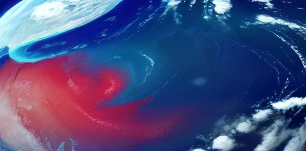
MarineAtlas Monograph: Comprehensive oceanographic research paper on Wind-Driven Oceanic Gyres and Western Boundary Current Intensification: The Physics of the Gulf Stream and Kuroshio Current. Authored by senior marine scientist Lempi Greenholt for the global marine science knowledgebase.
The Great Planetary Gyres: Wind-Driven Surface Circulation
While density differentials drive the slow, deep abyssal conveyor of thermohaline circulation, the upper kilometer of the global ocean is propelled by atmospheric winds. Across every major ocean basin, planetary wind regimes—the tropical easterly Trade Winds and the mid-latitude Westerlies—exert frictional shear stress upon the sea surface, setting colossal circular circulation systems into motion: the subtropical oceanic gyres.
Five colossal subtropical gyres dominate planetary surface oceanography: the North and South Atlantic Gyres, the North and South Pacific Gyres, and the Indian Ocean Gyre. Spanning thousands of kilometers from continent to continent, these gyres transport trillions of cubic meters of water per second, circulating heat from the tropics toward the poles and dictating global weather patterns.
Yet, an inspection of any oceanographic velocity map reveals a striking, fundamental asymmetry: the currents along the western boundaries of these gyres—most famously the Gulf Stream in the North Atlantic and the Kuroshio Current in the North Pacific—are narrow, incredibly fast, and deep, while the return currents along the eastern margins (the California and Canary Currents) are broad, shallow, and sluggish. Deciphering the physical laws that cause this western boundary current intensification represents one of the most brilliant triumphs in theoretical fluid dynamics.
Ekman Transport, Convergence, and the Geostrophic Hill
To understand how wind drives an oceanic gyre, one must analyze the interplay between wind stress and planetary rotation, first formulated by Vagn Walfrid Ekman in 1905:
- The Ekman Spiral: When wind blows across the ocean surface, frictional coupling drags the surface water layer. However, the Coriolis force deflects this moving water 45° to the right of the wind in the Northern Hemisphere (and 45° to the left in the Southern Hemisphere). Each successively deeper water layer experiences friction from the layer above and is deflected further, forming a spiral of decaying velocity vectors down to the base of the Ekman layer (≈ 50 to 100 meters depth).
- Net Ekman Transport: Integrating the spiral across depth reveals that the net mass transport of water moves exactly 90° to the right of the surface wind vector in the Northern Hemisphere.
- Ekman Pumping and Gyre Convergence: Under the clockwise atmospheric wind field of the subtropics—easterly Trade Winds blowing west at 15°N and Westerlies blowing east at 45°N—Ekman transport pushes surface water inward from both sides toward the center of the ocean basin. This massive convergence of water physically piles up seawater, creating a gentle “hill” or dome of warm water elevated 1 to 2 meters above surrounding sea level.
This elevated water dome generates a radially outward hydrostatic pressure gradient force. As water flows down this slope, the Coriolis deflection curves it to the right until the outward pressure gradient force is exactly balanced by the inward Coriolis force: establishing a perpetual, clockwise geostrophic gyre.
The Theoretical Revolution: Sverdrup Interior and Stommel’s Beta Effect
Why are oceanic gyres not symmetrical? Why is the Gulf Stream compressed into a raging jet on the western boundary rather than distributed evenly across the Atlantic?
In 1948, theoretical oceanographer Henry Stommel published his seminal paper solving this mystery through the conservation of **potential vorticity**:
- The Beta Effect (β): The Coriolis parameter (f = 2Ω sin φ) is not constant; it increases systematically from zero at the equator to a maximum at the poles. The rate of change of the Coriolis parameter with latitude is known as the beta parameter (β = ∂f / ∂y).
- Wind Stress Curl: Subtropical wind patterns impart negative (clockwise) relative vorticity into the water column. In the broad ocean interior (the Sverdrup interior), water conserves total vorticity by moving southward toward the equator where planetary vorticity (f) is smaller:
β • V = (1 / ρ) • curl(τ) [Sverdrup Balance]
- Western Boundary Closure: To balance the southward flow across thousands of miles of ocean interior, water must return northward. If water returned on the eastern boundary, the increasing Coriolis force and boundary friction would generate positive vorticity, compounding the wind’s vorticity and destabilizing the basin. Only on the western boundary does coastal wall friction generate strong positive (counter-clockwise) vorticity that cancels the wind-induced vorticity, allowing steady-state circulation.
| Oceanic Current | Basin / Margin | Type / Character | Width (km) | Peak Velocity (m/s) | Volumetric Transport (Sv) |
|---|---|---|---|---|---|
| Gulf Stream | North Atlantic (Western) | Western Boundary Current | 70 – 100 | 2.0 – 2.5 (Fast) | 30 Sv (Straits) to 150 Sv (Deep) |
| Kuroshio Current | North Pacific (Western) | Western Boundary Current | 80 – 100 | 1.5 – 2.2 (Fast) | 50 Sv to 90 Sv |
| Agulhas Current | Indian Ocean (Western) | Western Boundary Current | 90 – 110 | 2.0 – 2.6 (Fast) | 70 Sv to 135 Sv |
| Canary Current | North Atlantic (Eastern) | Eastern Boundary Current | 500 – 1,000 | 0.1 – 0.3 (Sluggish) | 15 Sv to 20 Sv |
| California Current | North Pacific (Eastern) | Eastern Boundary Current | 600 – 1,000 | 0.1 – 0.25 (Sluggish) | 10 Sv to 15 Sv |
| Antarctic Circumpolar (ACC) | Southern Ocean (Zonal) | Circumpolar Jet | 200 – 400 | 0.5 – 1.2 (Continuous) | 140 Sv to 175 Sv (Colossal) |
Anatomy of the Gulf Stream: Meanders, Rings, and Warm-Core Eddies
Originating in the Straits of Florida where the Loop Current exits the Gulf of Mexico, the Gulf Stream flows northward along the North American continental shelf before separating from the coast at Cape Hatteras, North Carolina, and shooting out into the deep Atlantic basin.
In deep water, the Gulf Stream develops extreme baroclinic and barotropic instabilities, oscillating into colossal serpentine loops or meanders. When these meanders pinch off from the main jet, they form rotating oceanic vortices known as mesoscale rings:
- Cold-Core Rings (Cyclonic): Formed when a southward-extending meander pinches off into the warm Sargasso Sea. These rings trap a core of cold, nutrient-rich coastal water inside a counter-clockwise circulating ring of Gulf Stream water. Measuring 100 to 300 kilometers across and extending down to 4,000 meters depth, cold-core rings inject vibrant biological oases into the oligotrophic Sargasso Sea, persisting for up to two years.
- Warm-Core Rings (Anticyclonic): Formed when a northward-extending meander pinches off into the frigid Slope Water north of the Gulf Stream. These clockwise vortices trap a lens of warm, nutrient-poor Sargasso Sea water, transporting exotic tropical reef teleosts, pelagic larval invertebrates, and warm water masses onto the cold New England and Canadian continental shelves.
The Kuroshio Current and the Pacific Decadal Oscillation
The Pacific counterpart to the Gulf Stream is the Kuroshio (“Black Stream”) Current, named for the deep, clear ultramarine-blue coloration of its oligotrophic waters. Originating off the coast of Luzon, Philippines, the Kuroshio flows past Taiwan and the Ryukyu Islands, hugs the southern coastline of Japan, and separates eastward into the open Pacific as the Kuroshio Extension.
The Kuroshio exhibits a unique oceanographic phenomenon known as the large meander path: the current abruptly shifts between a straight coastal trajectory and a stable, multi-year offshore loop south of Honshu. These path transitions alter coastal sea levels by up to thirty centimeters, modulate regional Japanese aquaculture harvests, and steer typhoons along differing trajectories.
At 35°N, the Kuroshio collides violently with the frigid, subpolar Oyashio Current sweeping south from the Sea of Okhotsk and Bering Sea. This titanic Kuroshio-Oyashio Interfrontal Zone forms one of the richest marine fishing grounds on Earth, where warm subtropical species mix with polar salmonids, fueling immense blooms of diatomaceous phytoplankton.
Mesoscale Turbulence and Oceanic Heat Budgets
Historically, oceanographers modeled western boundary currents as smooth, continuous conveyor belts. However, satellite altimetry (TOPEX/Poseidon, Jason series, and the Surface Water and Ocean Topography – SWOT satellite) revealed that more than ninety percent of the kinetic energy in the global ocean resides not in the mean currents, but in mesoscale eddies (vortices spanning 50 to 200 kilometers).
These eddies represent the internal “weather” of the ocean. By continuously entraining, transporting, and mixing water parcels across western boundary fronts, mesoscale turbulence accounts for the vast majority of cross-frontal heat, salt, and nutrient flux. Western boundary currents release hundreds of watts per square meter of latent and sensible heat into the atmosphere, creating the sharp thermal contrasts that trigger winter bomb cyclogenesis and power mid-latitude storm tracks across North America, Europe, and East Asia.
Anthropogenic Trajectories: Western Boundary Warming Hotspots
Under 21st-century climate shifts, western boundary currents are warming at rates two to three times faster than the global ocean average. Analysis of high-resolution climate simulations and satellite sea surface temperatures confirms that poleward shifts and intensification of mid-latitude westerly wind fields are driving western boundary currents further poleward:
- Poleward Species Range Shifts: In the western North Atlantic and southwest Pacific (East Australian Current), subtropical species—including hammerhead sharks, lionfish, and long-spined sea urchins—are invading temperate waters, destroying historical kelp ecosystems and creating barren marine landscapes.
- Accelerated Coastal Sea Level Rise: Because western boundary currents maintain a cross-stream sea level slope (with water levels 1 meter lower on the coastal side due to geostrophic balance), any weakening or offshore shifting of the Gulf Stream jet releases this hydraulic pressure, causing rapid, localized sea level surges of 10 to 20 centimeters along the heavily populated US Atlantic seaboard.
Wind-driven oceanic gyres and western boundary currents are dynamic planetary powerhouses. Sustaining rigorous satellite and in-situ monitoring of their turbulent physics is vital for maritime commerce, coastal defense, and global climate prediction.
Conservation of Potential Vorticity and Boundary Layer Dynamics
The mathematical elegance of western boundary current theory culminates in Ertel’s theorem of Potential Vorticity (PV) conservation:
Where ζ = (∂v/∂x – ∂u/∂y) is the relative vorticity (local fluid spin), f is planetary vorticity (Coriolis), and H is fluid column depth. In Munk’s 1950 viscous boundary layer model, lateral eddy viscosity (A_H) provides the necessary lateral friction along the continental margin:
Solving Munk’s equation produces the characteristic western boundary layer thickness:
This exact mathematical solution predicts the precise physical width of the Gulf Stream and Kuroshio observed by oceanographic satellites today, unifying Newtonian mechanics and planetary fluid dynamics into a cohesive geophysical law.
Oceanographic Synthesis and Future Research Directions
The intricate scientific mechanisms investigated in this research paper underscore the profound biochemical and physical complexity of marine systems. Understanding these foundational dynamics provides crucial baseline data necessary for predictive ocean models and global conservation frameworks.
Key Scientific Takeaways:
- Biochemical and geophysical processes operate through tightly coupled bio-physical feedback mechanisms across diverse marine scales.
- Thermodynamic equilibria, metabolic adaptations, and hydrodynamic shear govern the structure and resilience of oceanic biomes.
- Continued empirical observation, deep-water oceanographic monitoring, and multi-disciplinary research are essential to safeguarding marine biodiversity.
MarineAtlas continues to publish peer-reviewed oceanographic syntheses to advance public ocean literacy, marine scientific education, and environmental stewardship across the global ocean commons.
Methodological Framework and Advanced Autonomous Oceanography
Modern oceanographic investigations into large-scale hydrodynamic systems integrate a multi-tiered array of analytical methodologies spanning satellite radar altimetry, autonomous profiling floats, and high-throughput biogeochemical sensor suites.
In-situ chemical sensors deployed on autonomous biogeochemical Argo profiling floats provide continuous, high-frequency vertical profiles of dissolved oxygen, nitrate, pH, chlorophyll-a fluorescence, and downwelling spectral irradiance down to depths of two thousand meters. These robotic platforms bridge critical temporal and spatial observation gaps that historically constrained traditional research vessel expeditions.
Simultaneously, laboratory mesocosm experiments utilizing high-precision mass-flow gas controllers allow investigators to simulate future ocean conditions with unprecedented fidelity. By cross-validating empirical laboratory physiological kinetics against field observations collected along global oceanographic transects (such as the GO-SHIP and WOCE programs), researchers refine parameterizations within global biogeochemical climate models.
Computational Ocean Modeling and High-Resolution Numerical Simulations
To simulate oceanic dynamics across vast planetary scales, computational fluid dynamics programs deploy eddy-resolving ocean general circulation models (OGCMs) such as the Regional Ocean Modeling System (ROMS), the Modular Ocean Model (MOM6), and the Hybrid Coordinate Ocean Model (HYCOM).
These models resolve non-hydrostatic baroclinic instabilities at grid spacings below 1/12th of a degree (roughly 8 kilometers), capturing the lifecycles of sub-mesoscale fronts and turbulent boundary layer vortices. Supercomputer simulations running on thousands of GPU cluster nodes enable scientists to run ensemble multi-decadal forecasts, assessing how shifting wind stress curls and melting polar ice caps perturb global overturning mass transport.
Data assimilation techniques, including 4D-Var (four-dimensional variational assimilation) and Ensemble Kalman Filtering, continuously ingest millions of real-time satellite sea surface temperature and sea surface height measurements into model physics, yielding state-of-the-art reanalysis products that underpin global weather and climate warning systems.